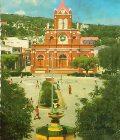
Thursday, July 17, 2008

17 - Zamboanga, Philippines


On the tip of Mindanao's western peninsula.

Zamboanga City brings its best foot forward during the popular Fiesta Pilar, celebrated in honor of the city's patron saint, La Nuestra Senora del Pilar de Zaragoza Our Lady of the Pillar of Zaragoza, Spain. A statue honoring the saint is prominently embossed above the façade on the eastern wall of the meter-thick walled fort called El Real Fuerza de Nuestra Señora del Pilar de Zaragoza (also called El Real Fuerza de San José in its early days). This Spanish military fort was built on June 23, 1635, by the Spanish Jesuit priest Fr. Melchor de Vera in defense against pirates and slave raiders. Zamboanga City is one of the oldest cities in the country and is the most Hispanized. It is also one of the largest cities in the world in terms of area, with over 1,480 km², including its 28 surrounding islands. Its recorded population in 2007 was 774,407.

Wednesday, July 16, 2008

16 - Yüan-ling, China


On the meridian that bisects Hai-nan.

Tuesday, July 15, 2008

15 - X Keten, West Papua, Indonesia


Mountain, E of Y Keten and Z Keten.

Monday, July 14, 2008

14 - Warrawagine, Western Australia


On the Oakover River, W of the Great Sandy Desert.

NPR story:
Located on the edge of the Great Sandy Desert in Western Australia, the Warrawagine Station has been one of the winners of climate change, thriving in nearly 24 inches of rain in the past year.

Warrawagine Station is home to more than 20,000 Droughtmaster cattle. The million-mile ranch depends on rainfall to get through the arid summer months, as the majority of the station has a desert-like landscape.


Sunday, July 13, 2008

13 - Victoria Downs, Queensland, Australia


S of Chapters Towers.
Victoria Downs, once Australia's largest pastoral property and the largest cattle station in the world, is synonymous with Sidney Kidman - the Cattle King. In the 1920s, after a malaria epidemic, John Flynn built a hospital on the station which was operated by the Australian Inland Mission until it closed down in 1942. Both the original homestead, which is located some kilometres south of the current Victoria Downs homestead, and the hospital are now listed as part of the National Estate.

Saturday, July 12, 2008

12 - Ulladulla, New South Wales, Australia


On the coast, 50mi. S of Wollongong.

The name "Ulladulla" comes from the aboriginal word Nulladulla, which means "safe harbour".
The town gained its first traffic light in the 1990s; one of its most notable landmarks is the Marlin Hotel with its big fluorescent marlin on the roof, which can be viewed from the sea.

Friday, July 11, 2008

11 - Timaru, New Zealand


On the W coast of the S island, between Christchurch and Dunedin.

Timaru has been constructed on rolling hills created from the lava flows of the extinct Mt Horrible volcano, which last erupted many thousands of years ago. The result is that most of the main streets are undulating, a clear contrast with the flat landscape of the Canterbury Plains to the north. This volcanic rock is used for the construction of local "bluestone" buildings.

Thursday, July 10, 2008

10 - Sandell Bay, Macquarie Island, Australia


On the lower W coast of the tiny island, well S of New Zealand, which is the southernmost bit of Australian territory.


Feral cats introduced to the island by whalers in the 19th century have had a devastating effect on the native seabird population, with an estimated 60,000 seabird death per year. In June 2000, the last of the nearly 2500 cats were culled in an effort to save the seabirds.
Although seabirds numbers began to rise initially, the removal of the cats caused an explosion in the number of rats and rabbits which together are causing widespread environmental damage. The rabbits too were an introduced species; by sealers in the 1800s as a food source and rapidly multiplied before numbers were reduced to about 10,000 in the early 1980s when myxomatosis was introduced. Rabbit numbers have now exploded to around 100,000 on the island.[4] The rodents feed on young chicks while rabbits nibbling on the grass layer has led to soil erosion and cliff collapses, destroying seabird nests. Large portions of the Macquarie Island bluffs are eroding as a result. In September 2006 a large landslip at Lusitania Bay, on the eastern side of the island, partially destroyed an important penguin breeding colony. Tasmania Parks and Wildlife Service attributed the landslip to a combination of heavy spring rains and severe erosion caused by rabbits.
There are currently plans to conduct the largest eradication program ever by mass baiting the island similar to an eradication program on New Zealand's Campbell Island, but there was an argument over which government, state or federal, will pay the estimated $24 million cost. On 4 June 2007 a media release by the Federal Minister for the Environment and Water Resources, Malcolm Turnbull, announced that the Australian and Tasmanian Governments had reached an agreement to jointly fund the eradication of rodent pests, including rabbits, to protect Macquarie Island's World Heritage values. It is expected to take up to seven years.

Wednesday, July 9, 2008

9 - Rongelap, Micronesia


E of Bikini.

Rongelap Atoll is an island-atoll located in Micronesia. It is a municipality of the Marshall Islands. The Atoll consists of 61 islets with a combined area of approximately 3 square miles (8 km²). Its lagoon covers 388 square miles (1,000 km²). It is historically notable for its close proximity to American hydrogen bomb tests in 1954.

The United States military conducted atmospheric nuclear weapons tests, including hydrogen bomb tests in the Pacific from 1946 through 1958. These tests were primarily in the Bikini Atoll, about 150 miles from Rongelap Atoll. On March 1, 1954, the test of the Castle Bravo hydrogen bomb generated radioactive fallout which killed a crew member of a Japanese fishing boat, the Daigo Fukuryū Maru, and contaminated Rongelap. The inhabitants were forced to abandon the islands, leaving all their belongings, three days after the test. They were relocated to Kwajalein for medical treatment.
In 1957, three years later, the USA declared the area 'clean and safe' and allowed the islanders to return [1]. Evidence of continued contamination mounted, however, as many residents developed thyroid-tumors, and many youngsters died of leukemia.[citation needed] The magistrate of Rongelap, John Anjain, appealed for international help, without significant response.
In 1985, Greenpeace helped evacuate the people from Rongelap and aided their resettlement on the islets of Mejatto and Ebeye on Kwajalein-atoll. Ebeye is significantly smaller than the islands of Rongelap, and joblessness, suicide, and overcrowding have proven to be problems following the resettlement.
In September 1996, the United States Department of the Interior signed a 45 million dollar resettlement agreement with the islanders, stipulating that the islanders themselves will scrape off a few inches of Rongelap's still contaminated surface. However, this is an operation deemed impossible by some critics. Now, however, the Mayor James Matayoshi says on his website that the project has been successful and was telling about a new promising future for the inhabitants and also for the tourists.

Tuesday, July 8, 2008

123 - Queen Maud Land, Antarctica


Home of two S African research stations.

Queen Maud Land is an English translation of Dronning Maud Land, the official name in use by Norwegian authorities and British Antarctic Survey on the part of Antarctica claimed by Norway as a dependent territory, on January 14, 1939. This claim, like all others in the Antarctic, is not universally recognized and is subject to the terms of the Antarctic Treaty System. It has a land area of approximately 2.5 million square kilometers (one million sq mi), mostly covered by the Antarctic ice sheet lying between the British claim, at 20°W and the Australian claim, at 44°38'E. Norway has not officially elaborated as to the northernly and southernly extent of their claim. This explains why the Norwegian claim is illustrated differently from other claims on some maps of Antarctica. It is however generally assumed that the Norwegian claim follows the norms of the other Antarctic claims. The Norwegian claim has been officially recognised by Australia, France, New Zealand and the United Kingdom. The territory is named for Princess Maud of Wales (1869–1938), Queen consort of King Haakon VII of Norway.

Monday, July 7, 2008

122 - Papetoai, Moorea, French Polynesia


Main town on the island's N coast. Its octagonal church is the oldest European building in the South Pacific.

Sunday, July 6, 2008

121 - Otoño, Argentina


30mi. N of Coronel Suárez.

Saturday, July 5, 2008

120 - Nazareno, Bolivia


Near the border with Jujúy, Argentina.

Friday, July 4, 2008

119 - Manizales, Colombia


100mi. W of Bogotá.

Thursday, July 3, 2008

118 - Lins, Brazil


In NW São Paulo state.

Wednesday, July 2, 2008

117 - Kwakoegroa, Surinam

50mi. S of Paramaribo. I'm pretty sure I transcribed it right, but Google turns up nothing. There's a Kwakoe festival in Amsterdam, celebrating Dutch-Surinamese culture, though.

Tuesday, July 1, 2008

116 - Jérémie, Haiti


Main town on the N coast of the southern peninsula.


Text not available
The Chautauquan Organ of the Chautauqua Literary and Scientific Circle

Monday, June 30, 2008

115 - Izalco, El Salvador

<

In the SW. The city's eponymous volcano (or the other way 'round) is one of the most famous and active in El Salvador.


Here's the town:


Saturday, June 28, 2008

113 - Golsovia, Alaska


On Norton Sound, S of Unalakleet. Now seems to exist largely as a river name.

Friday, June 27, 2008

112 - Fischer, Texas


25mi. W of San Marcos.

Seeds of the community were sown in 1876 with more than 3,000 acres acquired by brothers Herman and Otto Fischer. Herman claimed and stuck with 160 acres, building a small 3-section “dog trot” cabin -- part of it becoming the original Fischer’s store and the hub of “Fischerdale.” Otto, however, thought 3,000 acres would be more suitable for a livestock operation. It makes sense, then, that Herman became known as “Store” Fisher, and Otto known as “Stock” Fisher.

Over the years, Fischer’s store expanded far beyond its mercantile role to also become the community’s post office, “bank” and saloon -- the original 3-section cabin giving way to a larger frame building. At about 1900 it became the frame and tin structure we know today. Never one to miss a business opportunity, “Store” Fischer established a thriving cotton gin across the road at a spot now marked by two cedar trees in the open field.

Progress also brought name changes to Fischerdale, which quickly became Fischer’s Store. However, with the post office came a forced name change to simply Fischer, so the postmark wouldn’t “advertise” the store.


Here's a tractor patent by Fischer resident Kevin Wilson:

Thursday, June 26, 2008

111 - El Toro, California


NE of Laguna Beach.

Before it was decommissioned in 1999, it was the home of Marine Corps aviation on the West Coast. Designated as a Master Jet Station, its four runways (two of 8,000 feet (2,400 m) and two of 10,000 feet) could handle the largest aircraft in the U.S. military inventory. All U.S. Presidents in the post-WWII era have landed in Air Force One at this airfield.

Wednesday, June 25, 2008

110 - Delle, Utah


80mi. a of Salt Lake City.

Delle is a small enclave in Tooele County, Utah, along Interstate 80 near the Bonneville Salt Flats. The town has never had more than a few residents and has served primarily as a filling station along the I-80 corridor (and U.S. Route 40 corridor before it). Since the completion of the freeway the town has essentially become a ghost town.


Tuesday, June 24, 2008

109 - Chama, New Mexico


In the San Juan Mountains, just S of the Colorado line.

Text not available
Annual Reports By United States American Ethnology Bureau, Maritime Lumber Bureau

Monday, June 23, 2008

108 - Bassett, Nebraska


S of the Niobeara River, between Newport and Long Pine. "A shipping point for wild hay, the town was named for J.W. Bassett, a rancher, who drove the first herd of cattle into the section in 1871."

Sunday, June 22, 2008

107 - Atkins, Arkansas


80mi. NW of Little Rock.